During our trip to the Banff and Jasper National Parks, we saw many amazing places. However, it was the smaller, provincial park in Kananaskis Country that gave us the greatest pleasure. The trails are less crowded, which made us enjoy hiking more. Among the numerous routes, there are also unofficial ones that you won’t find in any guidebooks or tourist maps. Particularly noteworthy is the trail to Smutwood.
distance
1km
time
0h
elevation
1m
difficulty 1-5
0
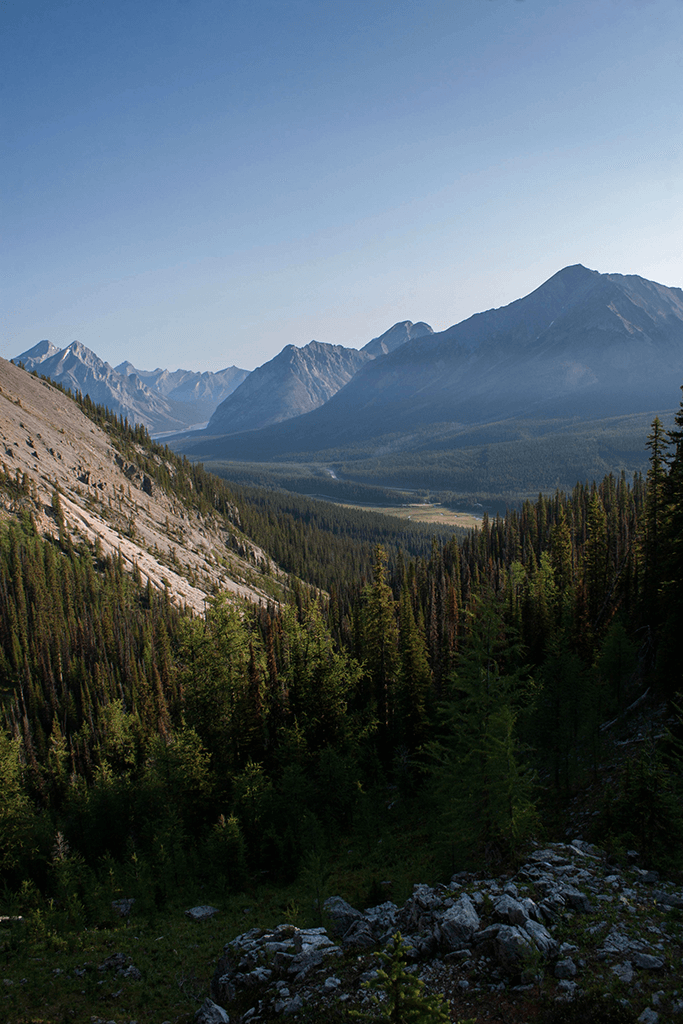
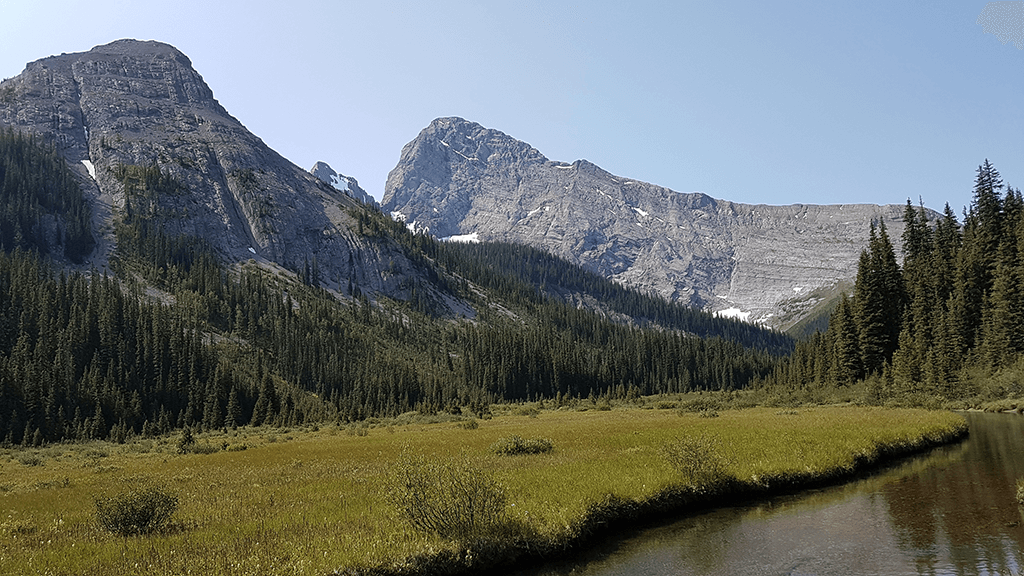
The name Smutwood was unofficially given by Andrew Nugar – the local author of best-selling guides. He referred to the location of the summit, which is located between Mount Smuts (2938 m) and Birdwood (3 097 m). Trekking towards Smutwood will provide experience for even the most demanding lovers of mountain hiking. Mountain streams, waterfalls and emerald lakes alternate with the greenery of forests, the color of meadows and the severity of stony hills.
DIRECTION SMUTWOOD
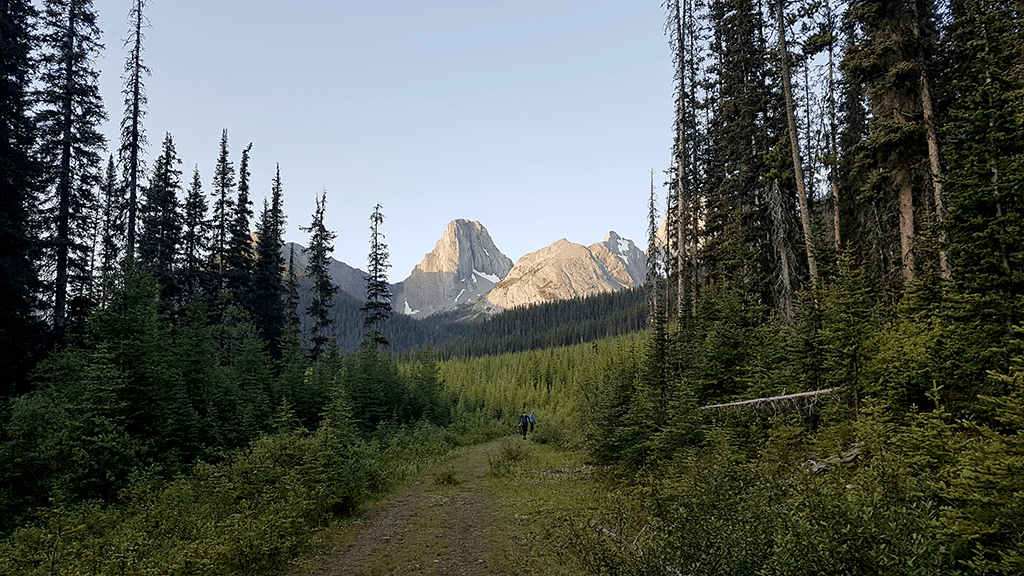
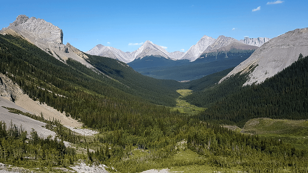
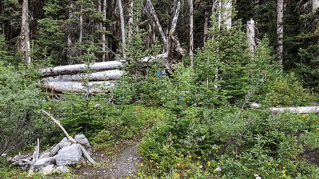
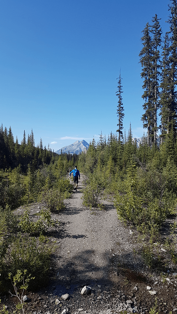
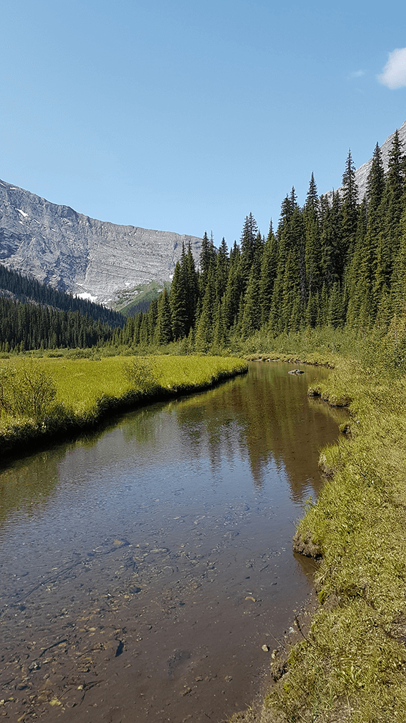
The journey begins on the former road, which once transported wood. Because we start just before the dawn, when the greatest activity of animals can be observed, it is obligatory to take a bear spray with us. After about 2.5 km we reach a fork and turn right. The trail leads along Commonwealth Creek up to the Smuts Pass.
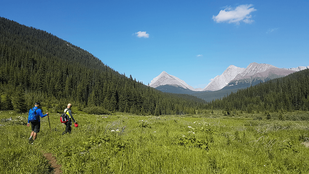
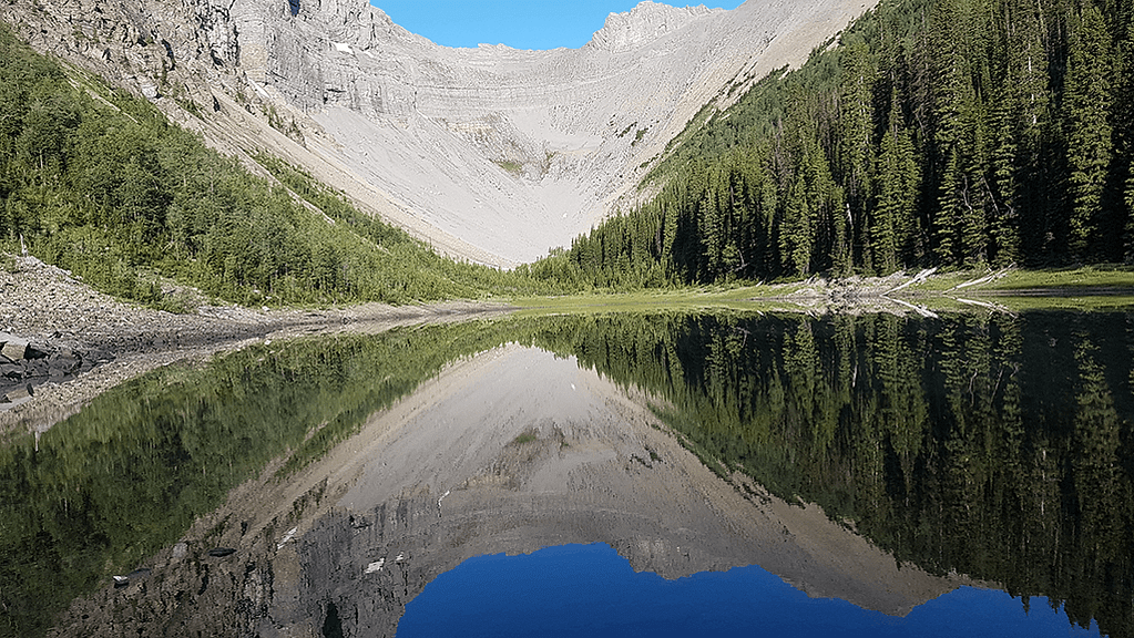
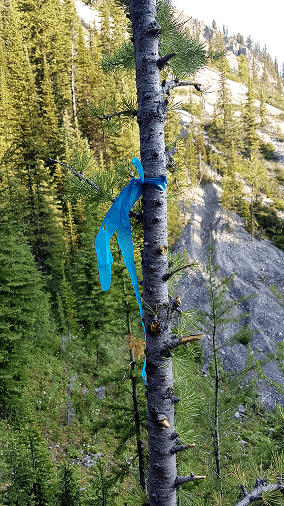
The path along the mountain stream can be muddy. Along the way, you can stop for a moment and breathe at the waterfall. Traversing the forest, winding paths, we finally reach a beautifully situated meadow. Surrounded by the mountain hills, full of colorful and fragrant flowers, it encourages you to stay longer. A quiet walk in the alpine landscape ends with a steep approach to the Smuts Pass. The trail is marked by ribbons, you should stick to them so as not to get lost among the avalanche debris.
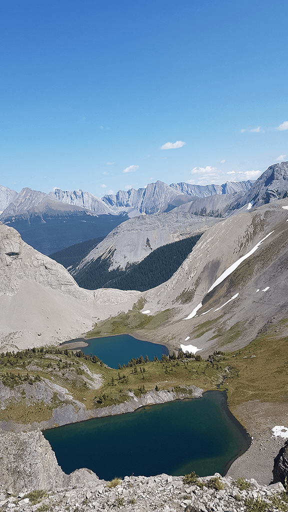
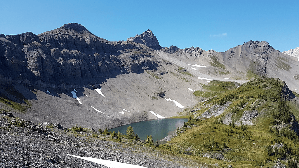
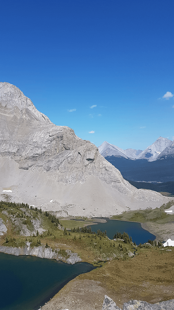
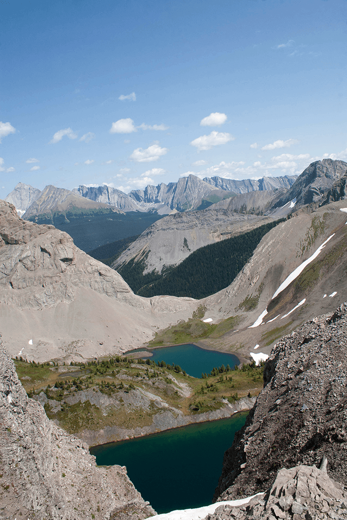
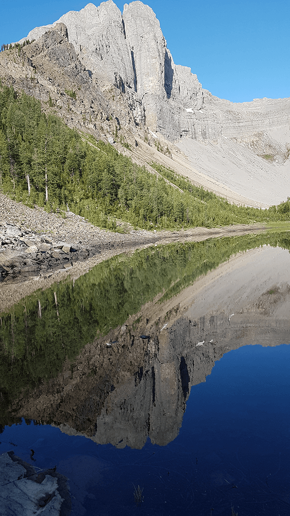
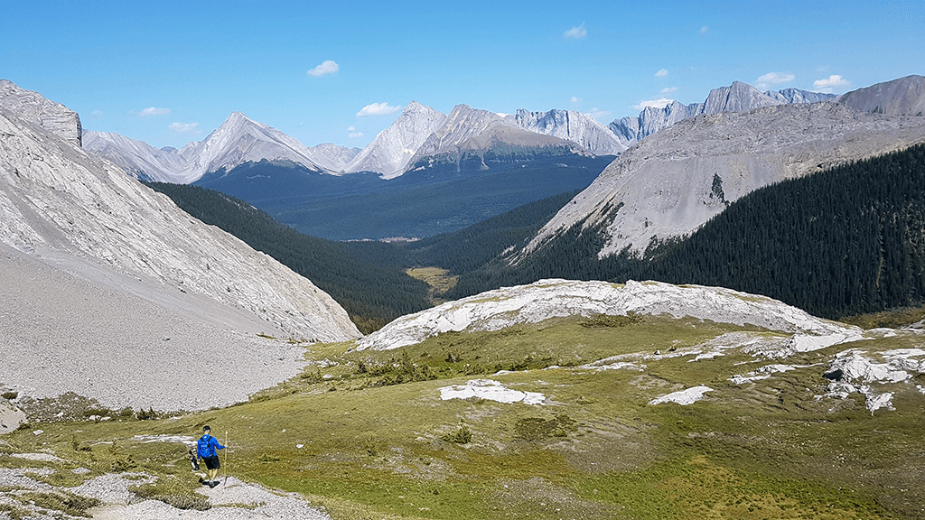
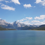
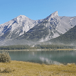
When we reach the pass, we see the Lake Birdwood, in which the peaks reflect in the turquoise water. We head left on a narrow path that winds up a steep slope. On the right, we see the second lake. The lakes due to their location are called the Lower and Upper Birdwood.
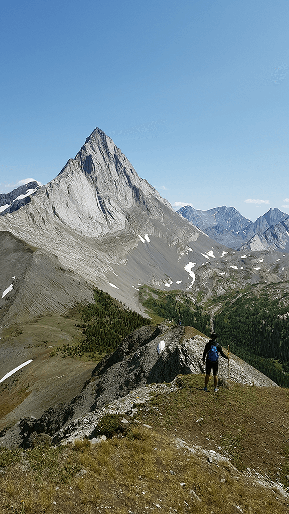
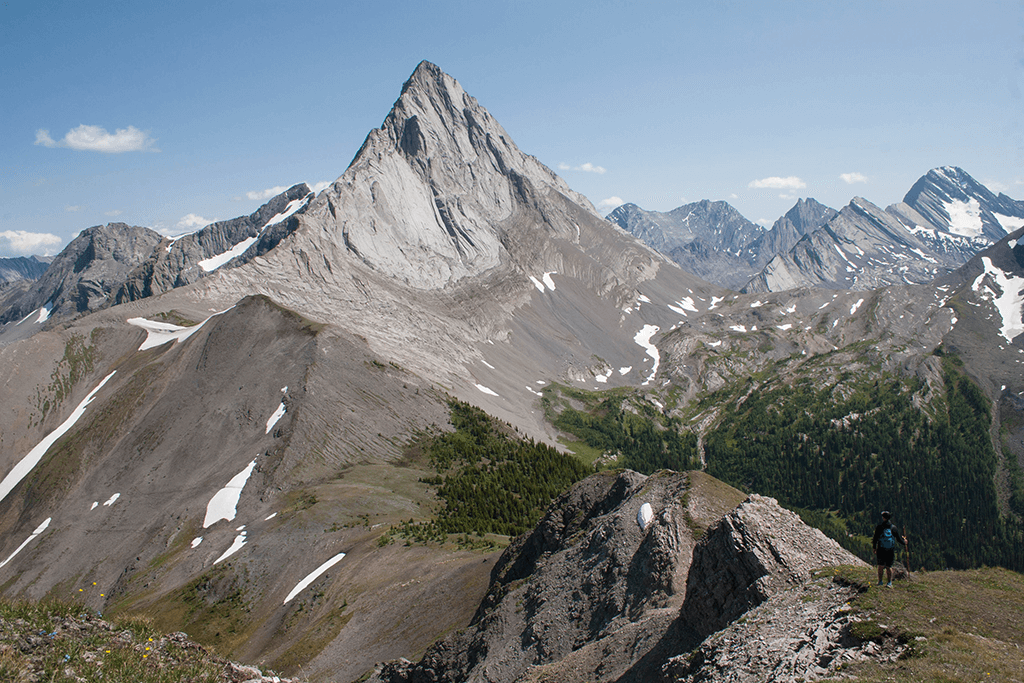
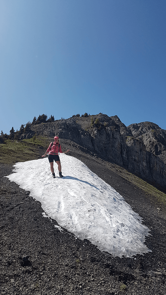
At the end of the pass, we start climbing uphill. The road to Smutwood is not difficult, but sometimes it requires us to be fit and prudent, especially with steep sections full of sliding stones. Climbing Smutwood Summit is the main goal of our climbing. However, it is Birdwood Mountain that turns out to be his greatest asset. Birdwood’s hallmark is its impressive ridges and its distinctive sharp peak that rises like an arrowhead. The green slopes surrounding the mountain and at the foot of Lake Birdwood soften its stern image. The views that spread from above are extremely spectacular and surround us from all sides.
FALSE PEAK
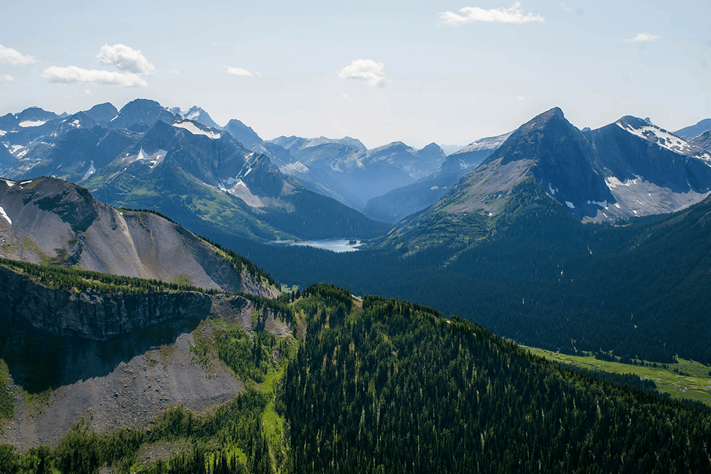
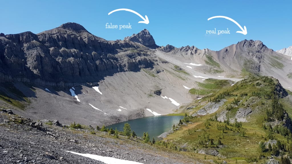
When climbing, you should pass a hill, which is often mistaken for a real peak. The views are equally great, but you should go further to be able to enjoy the eye with an even more beautiful landscape. Unfortunately, we never reached the real peak. The awareness of being so close to the desired goal, and at the same time so far away, makes regret creep into our hearts. Smutwood will remain in our memory for a very long time and give a reason to go back there again.
TRYST LAKE
distance
1km
time
0h
elevation
1m
difficulty 1-5
0
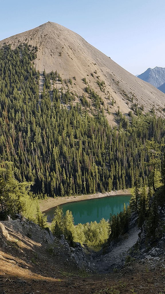
If you have more time and strength, you can go to Tryst Lake on the way back. It is a small lake, located between The Fist and Tent Ridge. The entrance to the trail is on the right, 1.6 km from the car park and should be marked with a ribbon. The trail leads through larch trees along the stream. The lake is shallow and charming, hidden among the forest hills with The Fist reflected in the surface, it looks more like a pond. It is worth climbing a little bit higher to admire the lake from above and enjoy the view of the mountain peaks. The entrance is unmarked and is located on the right side of the lake.
HOW TO GET TO THE TRAIL
Because both, Smutwood and Tryst Lake, do not appear as official trekking routes, access to them is also not marked. The start is in a small car park near the Smith Dorrien / Spray Lakes Trail (Hwy. 742). At the beginning you can head towards Engadine Lodge, which is the exit from Smith Dorrien. Then after driving about 1 km you will cross the bridge. Parking is on the left.
HOW TO PREPARE
It is a full day trekking. Especially if you want to go on the Tryst lake. It is best to start the trail at the dawn. You should stock up on a full day packed lunch. The trail is rich in streams and lakes from which water can be drawn. However, for your own safety, you should get water-purifying tablets or a filter. The mountain water is crystal clear, but animals also use it, which can threaten with giardiosis. The trail is provisionally marked. The marking sings are mainly sections where there is a risk of losing the road or entering a given trail – such as Lake Tryst, for example. Since this is not an official route, we will not find it on the official map either. It is worth downloading the offline map before setting off.
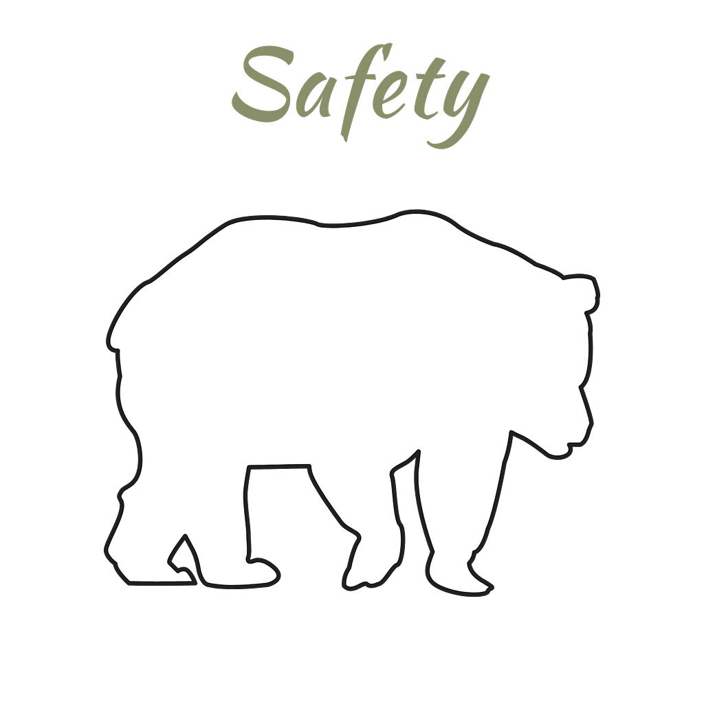
The routes are unofficial due to the high activity of grizzly bears in this area. When you go trekking, be carefull and stock up on bear spray. It is recommended to wander in a group of at least 4 people. However, if you go on a lonely trip, stick a bell to your backpack. There is nothing worse than a surprised bear.
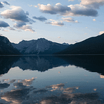
Read also - Spirits of Minnewanka Lake
While browsing the postcards in the gift shop, you happened to dream?. Sail away dreams to the place from the photo, and stay for a moment. Minnewanka Lake is one such place. Real lake, with history and ghosts
Read also - Spray Lakes Camping
Spray Lakes West Campground is located in Spray Valley Provincial Park Kananaskis, Alberta, Canada. The campsite is located along the scenic Spray Lakes Reservior, 16 km from Canmore. It is a first-rate camping, the better, which enjoys great interest.